SIGNIFICANT CHANGES IN NEW ONSLOW FLOOD MAPS
Onslow County’s new preliminary flood maps are available for public review by visiting THIS LINK
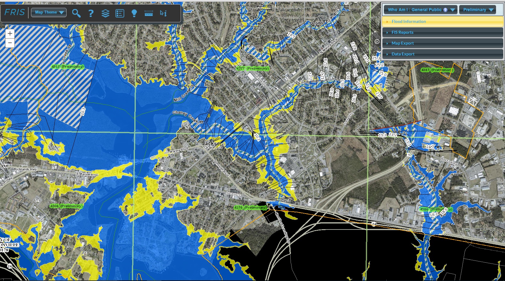
In the upper right corner of the screen, use the drop down menu to flip between the Effective (current) and Preliminary (new) maps. It is advisable to go to a specific property and see the impacts of the new maps. Above is a screengrab of Jacksonville, showing the new maps—and the extent of NEW areas in the flood zone.
Yesterday, NC Floodplain Mapping staff had a meeting with the development community to discuss the new maps. They indicated that Onslow and Carteret County will see “significant impact” with the new maps. The primary reason for the significant changes are technological. While the current 2005 map utilized information from 1982, the new preliminary map uses more advanced modeling. This has led to a significant number of new structures in the A zone (7200, vs 3700 under the current map) and a reduction of structures in the V zone (3500 currently, 2000 under the new map).
Please note that the publication of the preliminary maps begins a formal review, appeal and compliance process. The adoption and effective date of the new map is not likely until 2018. Nonetheless, please look at properties NOW to determine impacts from the new maps. Inshore increases in Base Flood Elevation will have major impacts on real estate.
To read a thorough story on the new maps from the Jacksonville Daily News, click here